Artificial Intelligence
How Google’s ‘Virtual Satellite’ AlphaEarth Is Redefining Global Earth Mapping

Accurate Earth mapping is essential for understanding climate change, urban growth, and resource management. Traditional satellite-based methods often struggle with data gaps and slow processing. To address these challenges, Google DeepMind developed AlphaEarth Foundations, an AI-driven “virtual satellite” that creates detailed and consistent maps even for regions where satellite data is limited or noisy. This article explains how AlphaEarth works, its key benefits, and its real-world impact.
Understanding AlphaEarth
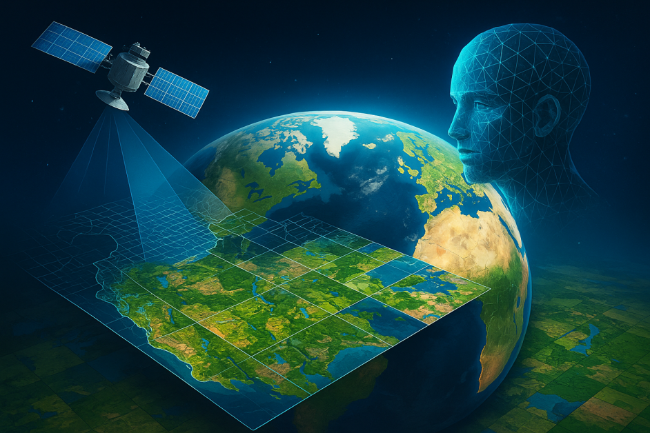
AlphaEarth Foundations is not a physical satellite that orbits the Earth. Instead, it is an advanced AI system that processes and fuses massive amounts of Earth observation data. The system functions as a ‘virtual satellite’ because it can generate summaries of Earth observation data over time. Traditional Earth observation depends on satellites that only pass over certain areas at specific times. As a result, the data collected is often incomplete and has gaps over time. The AI model addresses this problem by learning to fill in missing data and generate continuous records, even when satellite information is limited or unavailable.
AlphaEarth integrates data from a wide range of sources, including optical satellite imagery (e.g., Sentinel-2, Landsat), radar data, 3D laser mapping (LiDAR), digital elevation models, environmental datasets, geotagged text, and other contextual data. The AI combines these different data sources to create a unified digital summary, known as an embedding. AlphaEarth creates these embeddings for every 10×10 meter square across all land and coastal waters on Earth. These embeddings are compact, information-rich vectors that capture enough detail to track changes over time across various data sources, such as vegetation cycles and urban development patterns.
This virtual satellite approach overcomes key limitations of traditional methods. Unlike physical satellites, AlphaEarth Foundations are not limited by satellite orbits or affected by cloudy weather. It can generate up-to-date, ready-to-use maps whenever needed, even for remote or frequently cloud-covered areas. This system acts like a meta-satellite by intelligently integrating and harmonizing data from different Earth observation platforms. The result is a single, continuously updated, and detailed view of the planet that simplifies the process by eliminating the need to manage multiple satellite systems.
The AI Technology Behind AlphaEarth Foundations
At its core, AlphaEarth is built on a foundational geospatial embedding model. Foundation models are large AI systems trained on vast, diverse datasets to recognize broad patterns and structures. This general understanding allows them to be adapted to many specialized tasks with relatively little additional training.
AlphaEarth Foundations uses a novel architecture called “Space Time Precision” (STP), designed to capture fine details and broad trends across both space and time. The model processes spatial, temporal, and resolution details at the same time. This approach ensures that local information is preserved while also capturing larger patterns and trends over time. Additional pathways in the network incorporate external details, such as geotagged text, to ensure the system’s outputs are anchored in real-world context.
The model uses self-supervised and contrastive learning methods, allowing it to reconstruct and predict missing data points. This makes it highly robust when working with incomplete or noisy data. Its dual model training approach, using both “teacher” and “student” models, further ensures reliable performance even if some input sources are missing.
A key feature of this model is its efficient data processing. It compresses observations into a 64-dimensional vector, reducing storage requirements by 16 times compared to previous systems. This efficiency makes planetary-scale analysis much more practical and cost-effective.
How AlphaEarth Sets a New Standard in Mapping
AlphaEarth Foundations delivers significant improvements over existing methods by offering greater detail, consistency, and accuracy in earth mapping. The system not only provides higher resolution but also interprets and combines data to reveal subtle patterns that are often overlooked by both the human eye and traditional mapping techniques.
One of AlphaEarth’s key strengths is its ability to produce reliable, high-resolution maps even in challenging conditions. By integrating radar data, which is not affected by cloud cover, the system can “see through” persistent weather and provide accurate maps of areas such as agricultural fields and remote regions like Antarctica, where optical imaging is often limited.
AlphaEarth’s innovative “continuous time” capability allows it to track changes over time. Instead of relying on infrequent satellite passes, the model can interpolate or extrapolate missing data, creating detailed maps for any date range. This capability allows AlphaEarth to track changes over time, fill gaps in historical records, and deliver consistently up-to-date information, critical for timely responses to environmental events.
Performance evaluations have shown that AlphaEarth Foundations is highly accurate. On average, it delivers a 24% lower error rate compared to leading alternatives. It also excels in “low-shot” scenarios, where very few labeled examples are available. It matches or outperforms specialized, expert-tuned models across a wide range of mapping tasks and periods, from land use classification and crop type identification to forest monitoring and surface property estimation.
Most importantly, AlphaEarth’s robust performance in data-poor environments is a crucial advantage for global monitoring efforts. Many regions of Earth have limited ground-based measurements or satellite coverage, making traditional mapping approaches unreliable. AlphaEarth can generate accurate maps even in these data-poor environments by using its comprehensive, multi-source training that ensures precise, up-to-date insights everywhere on Earth.
Advancing Geospatial Access
A key benefit of AlphaEarth is that it is openly accessible to all. The annual “Satellite Embedding dataset,” based on AlphaEarth Foundations, is available on Google Earth Engine. This means users do not need to manage complex AI models or handle intensive computations themselves. By making high-quality geospatial data easily accessible, AlphaEarth empowers organizations of all sizes—including those in developing countries, local governments, and academic groups—to use advanced Earth observation tools. With just a few lines of code, users can access and analyze global geospatial data that was previously out of reach for most. AlphaEarth Foundation is also integrated with other Google Cloud solutions like BigQuery and Vertex AI. This integration allows both public and private sector users to access detailed climate insights and advanced land management tools.
Real-World Applications
Before its public release, AlphaEarth was tested by over 50 organizations around the world. The feedback was very positive, especially regarding the speed and quality of map creation. For example, MapBiomas, an environmental monitoring group in Brazil, uses AlphaEarth to track land use and deforestation in the Amazon rainforest. The model enables them to detect illegal clearing more quickly and develop better land management strategies.
Another application is the Global Ecosystems Atlas, a project aimed at mapping all ecosystems on Earth, including those previously underrepresented. AlphaEarth helps classify challenging areas such as remote deserts and coastal zones, providing scientists with better information to guide conservation efforts.
International organizations like the United Nations Food and Agriculture Organization use AlphaEarth for agricultural monitoring. Universities and research institutes also benefit from its ready-to-use data, allowing them to focus on analysis instead of data preparation. As a result, tasks that took weeks or months can now be completed in days or even hours.
Challenges and Considerations
Despite its advanced capabilities, AlphaEarth Foundations has some limitations that users should be aware of. The model requires significant computational resources for both training and inference, so it is mainly available through cloud-based platforms rather than local installations. This reliance on external infrastructure may limit its adoption in specific regions or use cases.
The accuracy of results depends heavily on the quality and coverage of input satellite data. While the model can estimate missing information, areas with consistently poor satellite coverage may have reduced accuracy. Users need to understand these limitations when interpreting results for critical applications.
Data privacy and sovereignty are also important considerations when using global AI systems for local environmental monitoring. Countries and organizations need to be aware of how their geographic information is processed and stored when using these Earth observation tools.
The Bottom Line
AlphaEarth Foundations are setting a new standard in global earth mapping. By using advanced AI, it delivers detailed and reliable maps, even for areas with limited or missing satellite data. This gives organizations, researchers, and policymakers faster and more accurate information for critical decisions about climate, land use, and resource management. While AlphaEarth relies on cloud platforms and the quality of input data, it makes advanced earth observation tools more accessible and practical for users around the world.


